|
|
|
|
|
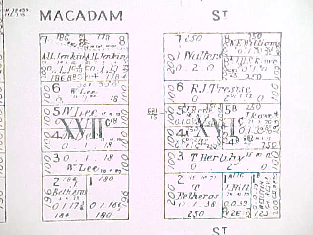
Richard purchased Lot 6 in East Street. East Street (not labelled) is on the extreme right of the map. The area of the Lot is given in acres, roods and perches in the large numbers below Richard's name, i.e. 0 2 0. The Lot's dimensions are shown in links, i.e. 100 x (250 + 250). Each measure results in half an acre, which is 0.2 of a hectare. Hard to decipher on the map are the markings directly below Richard's name. These give the date of the purchase, i.e. 30 7 72. (Note: Such maps as this are re-published periodically but the data they contain does not alter. They are a permanent record of the initial purchasers of Crown Grants.) |
|
Links to the
rest of the collection are below this image.
|
|
|
|
|
| Links
to the rest of this collection
(Note: Viewing the maps in the listed order will give you a 'zoom out' effect.)
|
| Tresise-Pollard Collection Home |
|
|